
Knocknascollop NW Top [Carrowmore Hill] [Cnoc na Scolb]
Good walks are even better shared.
Overview
Knocknascollop NW Top (Cnoc na Scolb)
Nestled in the scenic County Sligo, Knocknascollop NW Top, also known as Carrowmore Hill, offers a delightful escape into the Irish outdoors. Standing at an elevation of 300 meters, it may not be the highest peak, but it surely holds its own in terms of stunning vistas and historical intrigue.
Geology
The geological features of Knocknascollop NW Top are fascinating. Composed mainly of sandstone and limestone, this terrain tells a story of ancient earth movements. The stratified rocks add to the visual complexity – you may find yourself mesmerized by the patterns if you are not careful! And yes, we all know that it's rocky, so hold on to your hiking poles!
Routes
One of the most popular routes is the Carrowmore Hill Circuit, measuring approximately 8.5 km in length and taking roughly 3.5 hours to complete. This gladdening loop combines an invigorating climb with a stroll past ancient burial tombs – it’s both an exercise for the body and a humbling encounter with history. Just remember your water bottle; you’ll need the energy!
Summit Features
At the summit, you will find a modest yet charming cairn, perfect for a well-deserved rest. The panoramic views from the top are nothing short of spectacular. Grab your camera because you can snap a picture that even your Instagram followers will admire!
Terrain
The terrain consists of a medley of grassy slopes and rugged rocks, ensuring that your hike remains engaging. However, beware of the boggy patches that may invite you to a squishy surprise – nothing like a bit of mud to remind you that you’re in Ireland!
Views
The exhilarating views from Knocknascollop NW Top include sights of Sligo Bay, the majestic Ox Mountains, and possibly even the famed Benbulben lurking in the distance. The best time to enjoy these views is during late spring through early autumn, barring any sudden shifts in the notorious Irish weather. So pack those layers!
Hazards
As with any trek in Ireland, be prepared for swift weather changes. Slippery rocks and a few friendly sheep wanting to join your journey pose additional hazards. Don't let the intrigue of a bog consume your boot – always tread carefully!
Nearby Summits
You’ll find other notable peaks nearby, such as Carrowkeel and Ballygawley Hill, each with their own unique flavour of charm and challenge.
Access
Accessing Knocknascollop NW Top is relatively easy, with a small car park available near the start of the Carrowmore Passage Tombs. Public transport is limited, making a car the best option unless you fancy a walk from Sligo town, which is about 12 km away.
Facilities
While facilities aren’t plentiful on the mountain itself, Sligo town isn’t shy in offering its bounty. After your hike, treat yourself to a well-deserved meal or snack at one of the many cafes and restaurants in the area.
History
The name 'Cnoc na Scolb', translating to 'Hill of the Blades', hints at the area's wealth of historical significance. The adjoining sites of the Carrowmore Megalithic Cemetery showcase the ancient cultures that once thrived in this landscape. Think of it as history’s way of reminding you not to take your hikes (or life) too seriously!
In essence, Knocknascollop NW Top is a fantastic choice for anyone looking to enjoy the beauty of the Irish outdoors, filled with history, intrigue, and breathtaking views. Lace up those hiking boots, and venture forth!
Explore routes near Knocknascollop NW Top [Carrowmore Hill] [Cnoc na Scolb]
Public walks starting within 80 km of this hill. Nearby does not mean a route reaches the summit; check its map and access before setting out.
No public routes are currently listed within 80 km of Knocknascollop NW Top [Carrowmore Hill] [Cnoc na Scolb] on Walkmates. This does not mean there are no paths here. Explore the map and check local access information before planning a walk.
Route planning notes
These notes describe possible approaches, not verified navigable routes or permission to cross land. Check current paths, local access rules and conditions before setting out.
Carrowmore Hill Circuit
A delightful loop that combines a pilgrimage around ancient tombs with a climb to the summit. You'll encounter wildlife and a few boggy patches for that authentic Irish experience.
Make a day of it, together
Find someone to share the walk with, or organise a day out along a route you like.
Hill facts and local notes
Classifications
Elevation
244m
801 ft
Prominence
232m
Coordinates
54.2022, -9.8381
F801297
OS Map
22
At the Summit
The summit features a modest cairn, which is a fantastic spot for a snack break and a well-deserved selfie. The view stretches out in all directions – it's picture-perfect!
Terrain & Geology
The mountain is primarily composed of sandstone and limestone, adding to its distinct, rugged character. Expect some impressive stratification and the occasional scree slope, making footing an entertaining challenge.
Views & Scenery
From the summit, you can see the stunning expanse of Sligo Bay, the Ox Mountains, and even distant glimpses of Benbulben. On a clear day, it's a feast for the eyes!
History & Heritage
Name Origin
The name 'Cnoc na Scolb' translates to 'Hill of the Blades', possibly referencing the surrounding valleys that were once vital for blade-making in ancient days.
Historical Significance
The area is rich in historical sites, especially the Carrowmore Megalithic Cemetery, one of the largest cemeteries of its kind in Ireland. It showcases the ancient history and culture of the region.
Getting There & Facilities
Check current local access restrictions, parking rules and transport timetables before travelling. These notes do not confirm public access to the summit.
Parking
There is a small parking area near the start of the Carrowmore Passage Tombs, accommodating several vehicles. Arrive early to secure a spot, especially during summer!
Public Transport
Limited public transport is available; the best option is to drive. Sligo town is around 12 km away if you’re looking for buses.
Nearby Facilities
Facilities are scarce on the mountain, but Sligo town offers plenty of cafes, restaurants, and public toilets for use after your hike. Don't forget to indulge in some local delicacies!
Safety Information
Known Hazards
- Watch out for sudden changes in weather, slippery rocks, and the occasional enthusiastic sheep. Also, the bogs can be deceptive – what looks like a solid footing may just be a welcoming invitation for a soggy boot!
General Safety Tips
- Check weather conditions before setting out
- Carry appropriate clothing and equipment
- Let someone know your planned route
- Take a map, compass, and GPS device
- Carry emergency supplies: food, water, first aid kit, torch
Hills
Some common questions about the hills answered
Are there group walks up Knocknascollop NW Top [Carrowmore Hill] [Cnoc na Scolb]?
Many walkers use Walkmates to join or organise walks with others. You can check for group walks around Knocknascollop NW Top [Carrowmore Hill] [Cnoc na Scolb] through the maps
Are there other walkers around Knocknascollop NW Top [Carrowmore Hill] [Cnoc na Scolb]?
Activity varies by location and time, but Walkmates lets you see whether others have shared walks or shown interest in this area. Find other people through the walking friends search walking friends for Knocknascollop NW Top [Carrowmore Hill] [Cnoc na Scolb] search or of course create your own walk for Knocknascollop NW Top [Carrowmore Hill] [Cnoc na Scolb]
Can I organise a walk to Knocknascollop NW Top [Carrowmore Hill] [Cnoc na Scolb]?
Yes. If there aren’t any walks listed already, you can create a walk and make it available for others to join.
If you're signed up to Walkmates, you can create a walk to Knocknascollop NW Top [Carrowmore Hill] [Cnoc na Scolb].
How do I find a walk up this hill?
There are often multiple ways to walk this hill, depending on experience and route preference. Walkmates helps you explore walks and routes that others have shared.
Can I suggest a new route up Knocknascollop NW Top [Carrowmore Hill] [Cnoc na Scolb]?
Yes. You can suggest or create routes to share with others. Walkmates focuses on the social side of walking, so routes are used to help people organise walks and explore areas together, rather than as detailed navigation tools or route libraries.
Other uses really appreciate knowledgeable walkers sharing their routes. Share your favourite route to Knocknascollop NW Top [Carrowmore Hill] [Cnoc na Scolb] here
The is an error or something incorrect about this hill. How do I let you know?
We always strive to keep the information on Walkmates as accurate as possible. If you find an error, please let us know through the contact form and we'll aim to correct it as quickly as possible
Community Discussion
Comments
Location
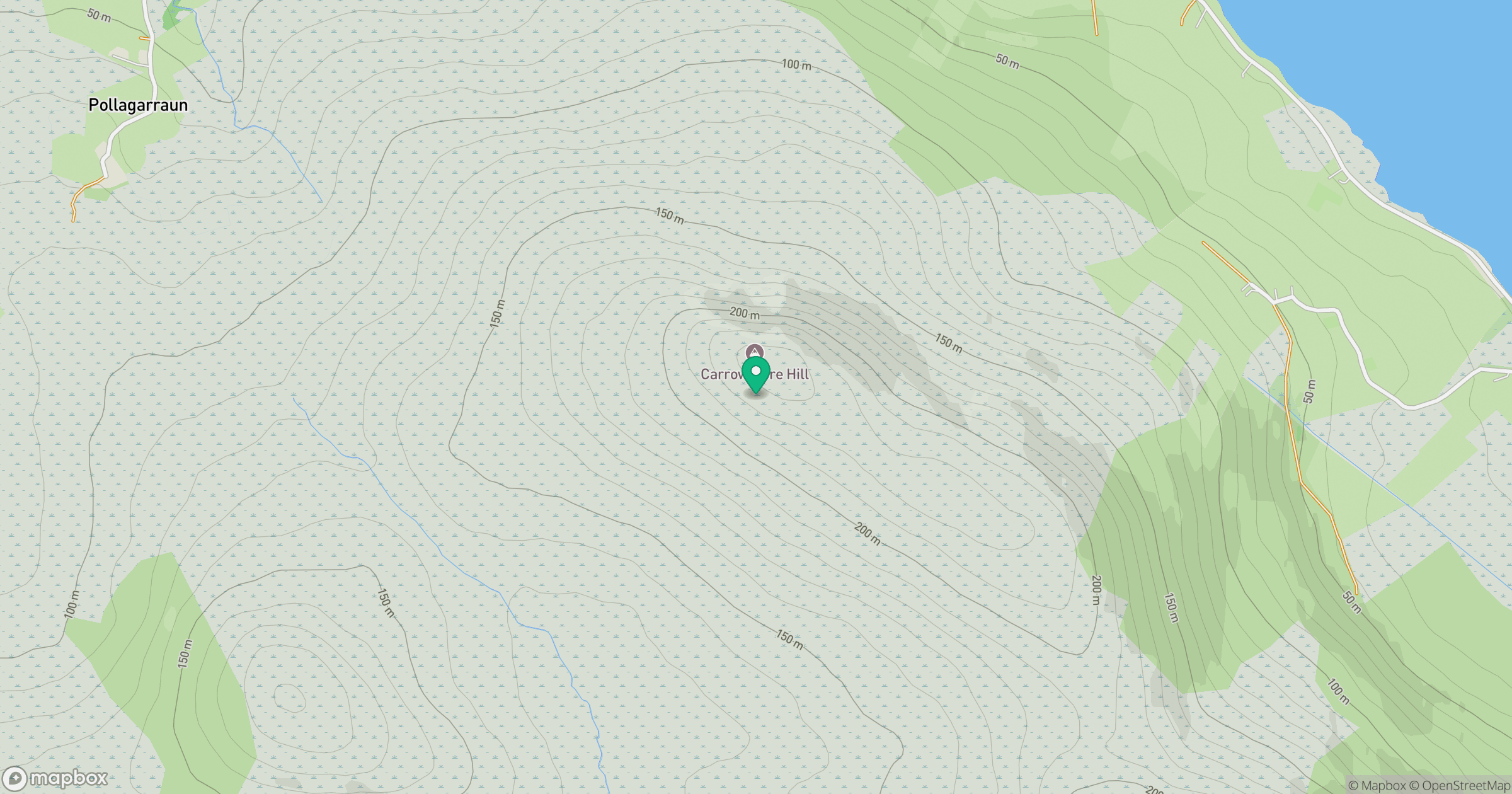
Grid reference: F801297
View on OpenStreetMapOpens a map in a new tab, centred on the hill.
Hills within 30 km
Straight-line distance, not a walking route or confirmation of access.
No comments yet. Be the first.